Science Behind Satellite Navigation Or Satnav System - Science/Technology - Nairaland
Nairaland Forum / Science/Technology / Science Behind Satellite Navigation Or Satnav System (1608 Views)
New Microsoft App Solves The Problem Of Indoor Navigation (2) (3) (4)
| Science Behind Satellite Navigation Or Satnav System by Nobody: 10:32pm On May 24, 2016 |
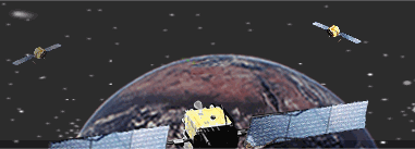
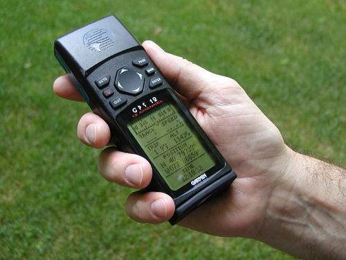
Satellite navigation ("satnav"  means using a portable radio receiver to pick up speed-of-light signals from orbiting satellites so that we can figure out our position, speed, and local time. It's generally much more accurate than other forms of navigation, which we have to contend with, pesky problems like accurate timekeeping and bad weather. Because it's a broadcast system based on radio signals that reach all parts of our planet, any number of people can use it at once, anywhere they happen to be. means using a portable radio receiver to pick up speed-of-light signals from orbiting satellites so that we can figure out our position, speed, and local time. It's generally much more accurate than other forms of navigation, which we have to contend with, pesky problems like accurate timekeeping and bad weather. Because it's a broadcast system based on radio signals that reach all parts of our planet, any number of people can use it at once, anywhere they happen to be.[img]http://www.e-education.psu.edu/natureofgeoinfo/sites/www.e-education.psu.edu.natureofgeoinfo/files/image/gps_movie.gif[/img] satnav employs trilateration to calculate the coordinates of positions at or near the Earth's surface. Trilateration refers to the trigonometric law by which the interior angles of a triangle can be determined if the lengths of all three triangle sides are known. satnav extends this principle to three dimensions. what is Triangulation Finding our position using satellite signals is a hi-tech version of an age-old navigator's trick that goes by the name triangulation. Suppose we are walking through the forest, on completely flat ground, but we don't know where we are. If we can see a landmark through the trees (maybe a distant hill), and we can guess how far away it is, we can look at a map and figure out that you must be somewhere on a circle whose radius (distance from the hill) is the distance we have guessed. One landmark alone can't narrow our position any more than this. But what if we suddenly see a second landmark in another direction. Now we can repeat the process: we must be a certain distance from that object too, somewhere on a second circle. Putting these two bits of information together and we know that we must be somewhere where the two circles meet—one of either two places on the ground. With a third landmark, we can narrow our position to a single point. And that's the essence of simple triangulation what is Trilateration Imagine we are standing somewhere on Earth with three satellites in the sky above us. If we know how far away we are from satellite A, then we know we must be located somewhere on the red circle. If we do the same for satellites B and C, we can work out our location by seeing where the three circles intersect. This is just what our GPS receiver does, although it uses overlapping spheres rather than circles. The more satellites there are above the horizon the more accurately our GPS unit can determine where we are. [img]http://www.nasa.gov/sites/default/files/styles/side_image/public/gps_signals.png?itok=6qah7pOp[/img] how satnav works There are three parts: the network of satellites, a control station on Earth that controls the satellites, and the receiving device. Each satellite is constantly beaming out a radio-wave signal toward Earth. The receiver "listens out" for these signals and, if it can pick up signals from three or four different satellites, it can figure out your precise location. The satellites stay in known positions and the signals travel at the speed of light. Each signal includes information about the satellite it came from and a time-stamp that says when it left the satellite. Since the signals are radio waves, they must travel at the speed of light. By noting when each signal arrives, the receiver can figure out how long it took to travel and how far it has come—in other words, how far it is from the sending satellite. With three or four signals, the receiver can figure out exactly where it is on Earth. we need a signal from a minimum of three satellites to fix our position this way and four satellites if we want to find our altitude as well. GPS satellites have atomic clocks on board to keep accurate time.  fun fact : each GPS satellite has 4 atomic clocks to be sure that one is always working, each costs > 100000 $ and is accurate to 1 billionth of a second. civilian grade GPS reciever [img]http://www.e-education.psu.edu/natureofgeoinfo/sites/www.e-education.psu.edu.natureofgeoinfo/files/image/gps_receiver.jpg[/img] however coordinates calculated when satellites are clustered close together in the sky suffer from dilution of precision (DOP), a factor that multiplies the uncertainty associated with User Equivalent Range Errors (UERE - errors associated with satellite and receiver clocks, the atmosphere, satellite orbits, and the environmental conditions that lead to multipath errors). two versions of satnav signals a highly accurate military-grade and a somewhat degraded civilian version . While military grade receivers could originally locate things to an accuracy of about 22m meters (72ft),civilian grade receivers were deliberately made about five times less accurate (to within the length of a football field, or about 100m) using a tweak called Selective Availability (SA). That was switched off by order of US President Bill Clinton in May 2000, greatly improving accuracy for civilian users, which is largely why GPS has taken off so readily ever since. Even civilian grade receivers are now officially accurate to within "13 meters (95 percent) horizontally and 22 meters (95 percent) vertically", though a variety of different errors (caused by the atmosphere, obstructions blocking line of sight to satellites, signal reflections, atmospheric delays, and so on) can compound to make them very much less accurate at times. uses of satnav 1.Navigation 2.Surveying and mapping 3.social networking 4.military applications 5.satellite communications etc |
| Re: Science Behind Satellite Navigation Or Satnav System by Nobody: 10:53pm On May 24, 2016 |
available satellite navigation system 1.GPS (america) The United States' Global Positioning System (GPS) consists of up to 32 medium Earth orbit satellites in six different orbital planes, with the exact number of satellites varying as older satellites are retired and replaced. Operational since 1978 and globally available since 1994, GPS is currently the world's most utilized satellite navigation system.  2.GLONASS (russia) or "GLObal NAvigation Satellite System", is a space-based satellite navigation system operating in the radionavigation-satellite service and used by the Russian Aerospace Defence Forces. It provides an alternative to GPS and is the second alternative navigational system in operation with global coverage and of comparable precision. 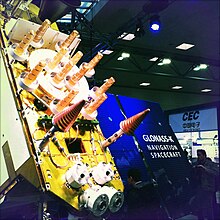 3.GALILEO (European union) it is the global navigation satellite system (GNSS) that is currently being created by the European Union (EU) and European Space Agency (ESA). The European system will only be subject to shutdown for military purposes in extreme circumstances, otherwise it will be available at its full precision to both civil and military users.  4.BeiDou (china) The second generation of the system, officially called the BeiDou Navigation Satellite System (BDS) and also known as COMPASS or BeiDou-2, will be a global satellite navigation system consisting of 35 satellites.  5.NAVIC (India) The Indian Regional Navigation Satellite System or IRNSS with an operational name of NAVIC is an Indian developed Navigation Satellite System that is used to provide accurate real-time positioning and timing services over India and region extending to 1500 km around India. The fully deployed NAVIC system consists of 3 satellites in GEO orbit and 4 satellites in GSO orbit, approximately 36,000 km altitude above earth surface. [img]http://1.bp..com/-NiW2rCYxlR0/Vv6sP9llm1I/AAAAAAAACCU/La9QuHxR2F8OWh1Bptepe1YdD4iRULgPg/s1600/IRNSS-1B%2BGallery1.jpg[/img] |
| Re: Science Behind Satellite Navigation Or Satnav System by Nobody: 11:35pm On May 24, 2016 |
GPS JAMMING/SPOOFING GPS signals are radio signals at a specific frequency. for example there are actually two major frequencies that GPS works on, one of which is for public, non-military use (1575.42 MHz) and the other is used solely for the US military (1227.6 MHz). Since GPS is nothing more than weak radio waves, these waves can be jammed or distorted using a GPS jammer. Jamming is the intentional or unintentional interference of the signal that prevents it from being received, which is relatively simple to do. Spoofing, on the other hand, is more challenging.It requires simulating the GPS accurately and capturing the user’s receiver away from the true signal to steer it off course. Doing this requires some very complex signal-generation equipment to track the vehicle first to exactly match its trajectory before you can start spoofing. Military receivers use encrypted GPS signals to ensure that they are receiving an authentic signal – so these are secure in that they can’t be spoofed most of the time. A common misconception, however, is that a secure military GPS receiver is immune to jamming. Signals from satellites are so weak that even a one-watt to 10-watt jammer can deny GPS coverage for a large area of both military and civilian signals. A 1-kilowatt jammer can block a military GPS receiver from as far away as 80 kilometers (50 miles). A Russian company has marketed a 4-kilowatt jammer that can deny a standard GPS signal within up to 200 kilometers (125 miles) however to deny GPS jamming/spoofing militaries now uses directional antennas that can be pointed directly at the satellites, reducing the receiver's sensitivity to jammers.also there are also ways to improve the operation of the electronics in the receiver, to make it more resilient. [img]http://1.bp..com/-8T5Ky9YupKw/VY7Ddz7YQjI/AAAAAAACBUE/RECzvE6VCdI/s400/LABS-master675.jpg[/img] Russian Krasukha-4 jammer that can render enemy precision weapons useless by suppressing guidance systems, including those relying on satellite signals. [img]http://www.drdo.gov.in/drdo/images/samyukta.jpg[/img] indian samyukta is a mobile integrated electronic warfare system which among other capabilites of electronic warfare can also jam satellite communications and block satnav signals.  chinese jammer combat vehicle etc 1 Like 1 Share |
| Re: Science Behind Satellite Navigation Or Satnav System by Nobody: 12:11am On May 25, 2016 |
Spoofing and jamming are two different problems, and the potential mitigation solutions for the user differ accordingly. Spoofing how hard is it To spoof a receiver, an adversary needs to faithfully recreate the signals from multiple satellites and then transmit that “spoofing” signal to capture a local GPS receiver. If the targeted GPS receiver is unable to tell the difference between the real satellite signals and the spoofed signals, the spoofing will fool the target receiver into appearing to be at a different location. he legacy GPS signals include an encrypted binary code of 1s and 0s known as Y-code that is transmitted on the L1 and L2 frequencies, with these signals only intended for military use. This encrypted binary code changes 10.23 million times per second, and the Y-code does not repeat over the course of an entire week (in other words, a unique sequence of 6.18 trillion 1s and 0s per satellite per week). Without the encryption keys it is virtually impossible for an adversary to generate the Y-code and, hence, virtually impossible to spoof a GPS receiver set to track Y-code. remedies: the best way to protect against spoofing is to directly track the encrypted Y-code. Of course, this is only possible by using a GPS receiver that has a Selective Availability Anti-Spoofing Module (SAASM). SAASM receivers can track Y-code only when loaded with the currently valid decryption key, and the modules are tamper-proof to prevent reverse engineering by adversaries. using multi-constellation receivers that can track multiple satnav signals An additional measure of protection can beadded by aiding the navigation solution with an inertial measurement unit (IMU), as an adversary cannot spoof the Earth's gravitational field or vehicle dynamics and cause the inertial unit to think it has moved in a way that it hasn't. jamming how hard is it A low received signal power makes satnav, susceptible to accidental interference and intentional interference (jamming). Once the interference level passes a certain limit, the satnav signal will be lost within the interfering signal.  remedies: 1. Filtering in the receiver. The first line of defense for interference of any type in any RF system is to filter out as much of the interference as possible as soon as it reaches the receiver. This is especially effective for what we call out-of-band signals, or signals that are not directly in the GNSS frequencies that we are trying to receive. Unfortunately, if a signal falls directly in-band it may still overpower the receiver. 2. Aid the receiver with an IMU. IMUs are impervious to radio frequency interference and can provide a navigation solution to bridge gaps of seconds to a few minutes in satnav performance. 3. Null the interfering signal by using an adaptive antenna array. By using multiple antenna elements spaced a known distance apart, signal-processing techniques can be employed to discern the direction from which an interfering signal is arriving and then adaptively change the apparent receiving strength of the antenna array, creating lower gain (“nulls”) in the antenna receiving pattern. By pointing these nulls towards the source of interference, the receiver can be protected from interference arriving from that direction.Controlled reception pattern antennas, are extremely effective at mitigating all types of interference, even if that interference falls within the GNSS frequency band. |
(1) (Reply)
MIT Students Design Solar Powered Car / Facebook May Destroy The Internet Soon. / How To Download On.com App For Iphone And Apple Ios
(Go Up)
| Sections: politics (1) business autos (1) jobs (1) career education (1) romance computers phones travel sports fashion health religion celebs tv-movies music-radio literature webmasters programming techmarket Links: (1) (2) (3) (4) (5) (6) (7) (8) (9) (10) Nairaland - Copyright © 2005 - 2024 Oluwaseun Osewa. All rights reserved. See How To Advertise. 36 |