Rossikk:
Great Zimbabwe Ruins - 1100 AD
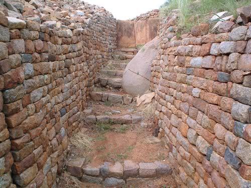
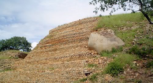
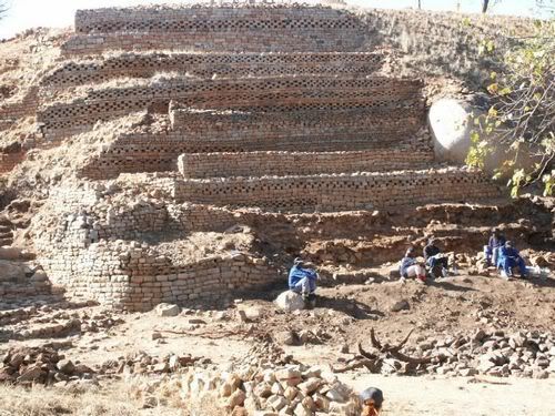
Great Zimbabwe is a ruined city in the southeastern hills of Zimbabwe near Lake Mutirikwe and the town of Masvingo. It was the capital of the Kingdom of Zimbabwe during the country's Late Iron Age. Construction on the monument by ancestors of the Shona people began in the 11th century and continued until the 15th century,[1][2] spanning an area of 722 hectares (1,780 acres) which, at its peak, could have housed up to 18,000 people. It is recognised as a World Heritage Site by UNESCO.
Great Zimbabwe served as a royal palace for the Zimbabwean monarch and would have been used as the seat of political power. One of its most prominent features were the walls, some of which were over five metres high and which were constructed without mortar.
https://media-cdn.tripadvisor.com/media/photo-s/02/f3/6a/64/great-zimbabwe.jpg
https://images.fineartamerica.com/images-medium-large/the-ruins-of-great-zimbabwe-were-built-james-l-stanfield.jpg
https://static0.demotix.com/sites/default/files/imagecache/a_scale_large/900-9/photos/1323740334-tourism-at-the-great-zimbabwe-ruins_918479.jpg
https://www.glengreen.co.za/images/gallery/pics/large/sa_25_large.jpg
Ruins of Kilwa Kisiwani (Tanzania) 800 AD
Kilwa Kisiwani is an archaeological city-state site located along the Swahili Coast on the Kilwa archipelago. It was occupied from at least the 8th century AD and became one of the most powerful settlements along the coast.
Kilwa Kisiwani reached its highest point in wealth and commerce between 13th and 15th centuries AD
https://images.essentialtravel.co.uk/et-magazine/feature/eco-kilwa-kisiwani.jpg
https://i.ytimg.com/vi/CNrah_OaLwU/maxresdefault.jpg
https://cdn.africatravelresource.com/africa/tanzania/c/kilwa/0/guidebook/1004-kilwa-ruins-600.jpg
https://whc.unesco.org/uploads/thumbs/site_0144_0027-594-0-20121111133403.jpg
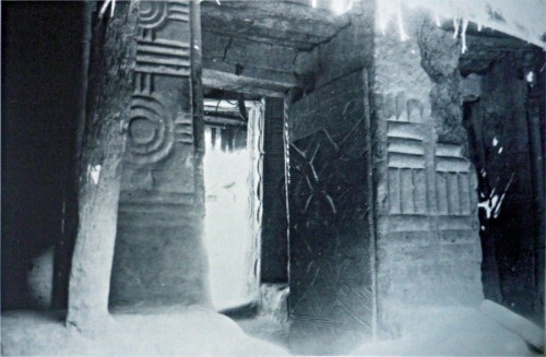
Replica of a Chief's House in Ancient Benin Nigeria
https://cache.virtualtourist.com/1407600-Bight_of_Benin_in_chiefs_house-Nigeria.jpg
The Walls of Benin, Nigeria: 800 AD
Man-made wonders of the world such as the Taj Mahal in India, the Cairo Citadel in Egypt and the Colosseum in Rome attract millions of visitors each year and lay claim to represent the architectural brilliance of our past. But the Benin Moat, also known as the Walls of Benin, lays fallow, crumbling away in Nigeria, a pale imitation of its resplendent former self. At stake is not just the structure itself, but the memory of a once-great empire and a site of colonial resistance.
A benign development?
The Benin Empire (1440–1897) was a pre-colonial African state, which at its height stretched from the western Igbo tribes on the shores of the Niger River, through parts of the south-west including present day Ondo State, and the isolated islands of Lagos. The empire was famed for nurturing of artistic creativity and using advanced techniques in its bronze and ivory sculptures (especially its life-sized bronze heads) that predate similar works in the Western world.
Construction started on the Walls of Benin in 800 AD, now situated in modern day Benin City, capital of Edo State, and continued into the mid-1400s. Stretching seemingly endlessly across the land, the Benin Moat is the world’s second longest man-made construction, falling short of only the Great Wall of China. The Walls of Benin, built as a city fortification against neighbouring rivals such as the Oyo Kingdom to the south and the Sokoto Caliphate in the north, is estimated to be 10,000 miles in length and 2,000 square miles in area. Excavations by British archaeologist Graham Connah in 1960 uncovered a rural network of earthen walls that, he estimated, if spread out over five dry seasons, would have required a workforce of 1,000 labourers working ten hours a day, for seven days a week to construct – a rough total of 150 million man hours.
Kano City Walls Nigeria 1100 AD
https://i1050.photobucket.com/albums/s417/KingMichael777/kano20city20wall20motna220jos_zps1a4768dd.gif
https://i1050.photobucket.com/albums/s417/KingMichael777/kanowalls_zps27e11e30.jpg
https://i1050.photobucket.com/albums/s417/KingMichael777/kanowalls2_zps6ea05c4a.jpg
Ancient Kano Houses
https://a10.idata.over-blog.com/0/30/00/23/kano/maison-typique-haoussa.jpg
https://www.afritecture.org/wp-content/gallery/bukabu/1147855064_29-mosque-hausa-kossa-n.jpg
Loropeni Ruins Burkina Faso
https://i1050.photobucket.com/albums/s417/KingMichael777/site_1225_0002-500-334-20100126120931_zps130d4b43.jpg
https://i1050.photobucket.com/albums/s417/KingMichael777/Loropeni-ruins_Ancient-ruins_4675_zpsf99c2f1b.jpg
The 11,130m2 property, the first to be inscribed in the country, with its imposing stone walls is the best preserved of ten fortresses in the Lobi area and is part of a larger group of 100 stone enclosures that bear testimony to the power of the trans-Saharan gold trade. Situated near the borders of Côte d’Ivoire, Ghana and Togo, the ruins have recently been shown to be at least 1,000 years old. The settlement was occupied by the Lohron or Koulango peoples, who controlled the extraction and transformation of gold in the region when it reached its apogee from the 14th to the 17th century. Much mystery surrounds this site large parts of which have yet to be excavated. The settlement seems to have been abandoned during some periods during its long history. The property which was finally deserted in the early 19th century is expected to yield much more information.
Brief Synthesis
The dramatic and memorable Ruins of Loropéni consist of imposing, tall, laterite stone perimeter walls, up to six metres in height, surrounding a large abandoned settlement. As the best preserved of ten similar fortresses in the Lobi area, part of a larger group of around a hundred stone-built enclosures, they are part of a network of settlements that flourished at the same time as the trans-Saharan gold trade and appear to reflect the power and influence of that trade and its links with the Atlantic coast. Recent excavations have provided radio-carbon dates suggesting the walled enclosure at Loropéni dates back at least to the 11th century AD and flourished between the 14th and 17th centuries, thus establishing it as an important part of a network of settlements.
Ancient Ghana Empire Ruins (Kumbi Saleh) 900 AD
https://i1050.photobucket.com/albums/s417/KingMichael777/kumbisaleh3_zps577f5620.png
https://i229.photobucket.com/albums/ee254/BabyHorus/Khami3.jpg
https://www.diawara.org/wp-content/uploads/2011/10/Empire_Ghana-3.jpg
https://i41.tinypic.com/2ujh91z.jpg
https://i229.photobucket.com/albums/ee254/BabyHorus/Khami2.jpg
https://i40.tinypic.com/o6fg35.jpg
https://i39.tinypic.com/i4plhg.jpg
https://i229.photobucket.com/albums/ee254/BabyHorus/khami1.jpg
Old Oyo Kingdom Ruins, Nigeria 1100 AD
https://csweb.bournemouth.ac.uk/africanlegacy/images/oldoyo.jpg
Onitsha Nigeria
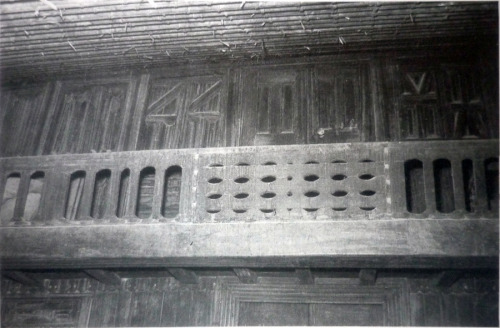
These houses are from titled men of Onicha and may have Benin influence.
https://24.media.tumblr.com/tumblr_m7xn4oxF5e1qjh37to1_500.jpg
https://24.media.tumblr.com/tumblr_m7omc84v631qjh37to2_500.jpg
https://24.media.tumblr.com/tumblr_m7omc84v631qjh37to3_500.jpg
Upstairs balcony.
Temple of Soleb, Sudan 1400 BC
https://i55.tinypic.com/j9owna.jpg
Ruins of Meroe, and Nubian Pyramids Sudan 1200 BC
https://farm3.staticflickr.com/2738/5718001719_2f91ecae36_z.jpg
https://farm6.staticflickr.com/5258/5417179268_3fcb7c7078_b.jpg
[img]http://orientenresor.se/da/files/2011/12/Nuri-F-31-700x350.jpg[/img]
https://graphics8.nytimes.com/images/2012/10/07/travel/07EXPLORER4/07EXPLORER4-popup.jpg
[img]http://www.peron4.pl/wp-content/uploads/2010/08/sudan_swiatynia.jpg[/img]
Timbuktu, Mali Empire 1100 AD
[img]http://quintessentialruminations.files./2012/04/timbuktu2.jpg[/img]
[img]http://1.bp..com/-RVdWwPdA8BI/T4iCkbFViCI/AAAAAAAAAFI/GNZczkXUTVo/s1600/b087.jpg[/img]
[img]http://3.bp..com/_kxPG6y8Qctk/TFbgsbe1OVI/AAAAAAAAexA/hqGathBBqSs/s800/Sankore+Mosque+-+TIMBUKTU+Photos+%289%29.jpg[/img]
[img]http://1.bp..com/_kxPG6y8Qctk/TFbgiZC_4tI/AAAAAAAAewY/dw3fQ0ZiF_c/s800/Sankore+Mosque+-+TIMBUKTU+Photos+%284%29.jpg[/img]
[img]http://ader.eu/francais/mali/mali3-maison_quartier_bamak.jpg[/img]
Gedi Kenya 1200 AD
https://www.kenya-advisor.com/images/gedi-ruins-malindi-kenya-all2817342.jpg
Ancient Temple Burkina Faso
https://farm8.staticflickr.com/7119/6888364100_1db02dba92_c.jpg
https://farm2.static.flickr.com/1391/854731780_61f38c5303.jpg
Ruins of Ethiopia (Dated: PRE-HISTORY)
https://globe-tourism.com/wp-content/gallery/4-fasil-ghebbi/2414262079_1a7a78b17d_b.jpg
https://globe-tourism.com/wp-content/gallery/4-fasil-ghebbi/2415645692_55e18b8550_b.jpg
https://globe-tourism.com/wp-content/gallery/4-fasil-ghebbi/800px-fasilidas_palace_gonder_ethiopia_04.jpg
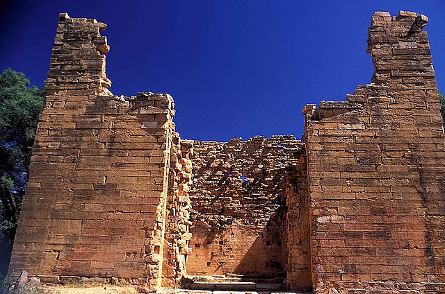
https://upload.wikimedia.org/wikipedia/commons/thumb/b/bd/Yeha_Tigray_Ethiopia.jpg/640px-Yeha_Tigray_Ethiopia.jpg
Lalibela Church Ethiopia - Entirely carved from one rock
https://www.historyforkids.org/learn/africa/architecture/pictures/betgiorgis.jpg
Obelisk of Axum Ethiopia
https://0.tqn.com/d/archaeology/1/0/n/A/axum_obelisk.jpg
Songhai Empire 1400
[img]http://everythingspossible.files./2008/06/p5010061.jpg[/img]
[img]http://everythingspossible.files./2008/06/p5010031.jpg[/img]
Ashanti Empire
https://img534.imageshack.us/img534/7648/precolonialghana50.png
Palace of the chief of Foumban Cameroun
https://i.imgur.com/87mLOPm.png
https://i.imgur.com/utXNhJy.jpg?1
https://i.imgur.com/GvyL0YS.jpg?2
https://i.imgur.com/Y2QGvkb.jpg?2
https://i.imgur.com/HPQm9TY.jpg?2
https://farm7.staticflickr.com/6061/6093258679_1d3c2eacc2_z.jpg
https://farm5.staticflickr.com/4051/4290914801_c780277c92_z.jpg?zz=1
Ancient Benin - British soldiers sitting inside the Oba's palace after burning and looting the complex (1897)
https://img846.imageshack.us/img846/5149/membersof1897britishmil.jpg
"Ivory Found in City." Courtyard of the Oba's palace, Benin City, February 1897, photographed by a Captain Walker. The object in the center of the courtyard, lying on a large brass cylinder, is a brass serpent head from the palace roof. R. K. Granville Archive Album 64.5, Pitt Rivers Museum, University of Oxford.
https://img833.imageshack.us/img833/5492/watercolorsketchofparto.jpg
A house in Benin city occupied by the British soldiers as a temporary residence.
https://img43.imageshack.us/img43/5725/ahouseinbenincityusedas.jpg
https://img190.imageshack.us/img190/396/31130397669160193672240.jpg
"The king's wall in Benin City. Benin, Nigeria. Silver gelatin print, 10.2cm x 13.9cm (4" x 5.5"Click the image to open in full size.. Photograph by J. H. Swainson, 1892. Macdonald Niger Coast Protectorate Album, A1996-190138."
The Great Sphinx Egypt (Dated PRE-HISTORY)
[img]http://www.studentsoftheworld.info/infopays/photos/EGY/orig/Sphinx.jpg[/img]
https://upload.wikimedia.org/wikipedia/commons/3/3f/Great_Sphinx_of_Giza_0912.JPG
[img]http://bolstablog.files./2010/03/sphinx-riddle.jpg[/img]
Pyramids of Giza Egypt
https://media-2.web.britannica.com/eb-media/31/83831-004-4AE615AA.jpg Why and how did we Africans allow ourselves to fall? |